Hiked 4/19/09
Having explored a majority of the Cleveland National Forest Trails originating from the famous Ortega Oaks Candy Store parking lot, I decided to see what the other trailheads had to offer further up the Ortega Highway. Thus, this brought me to the Blue Jay Campground. Getting there is easy, only a few miles past the candy store, but I would soon learn the trails would not pose such an easy of a challenge.
Parking in the lot just south of the campground, the trailhead is easy to find. Just look beyond the park map sign, and you will see the path. You will soon be faced with the first of numerous unmarked forks on the trail. I learned by luck, or maybe intuition, to follow the more heavily traveled path that leads downhill. The first few miles take you steadily down the canyon (this is what makes it tough, think of the trip back).
There are many scenic views to take in early on, including mountain vistas, Pacific Ocean, Catalina Island (on clear days), south Orange County, and the canyon below. You pass through oak woodlands, coastal chapparel, and sage throughout the duration of this hike.
Canyon and mountain vistas

Pacific Ocean View

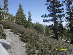
There is periodic shading throughout the trail. This was helpful, as the day we went the mercury easily passed 90 degrees.
Large Oaks Providing Shade

Eventually you will reach a lush meadow. known as the Chiquito Basin. The first explorer of the region named this area after their horse, Chiquito. There are also Indian morteros around, but I never came across any.
Lush Meadow

After a short distance in the meadow, you will round the bend and reach the intersection of the San Juan trail which takes you to Sugarloaf Peak, Viejo Tie Trail, and the start of Chiquito Trail. I chose to continue down the Chiquito trail for a short distance, then retrace my steps back to my car. Keep in mind, the farther you go down this trail, the more uphill climbing you will have on your way back. This may not be a big deal on a cool day, but when it is 90+ degrees, you will not want to over exert yourself.
All in all, this is a typical Cleveland National Forest trail. The only downside to this part of the forest is that mountain bikers are allowed, whereas the wilderness areas do not permit them. However, I only encountered a handful of bikers, and they were courteous.
Pros: Nice views, light traffic on the day I went, nice meadow
Cons: The way back is all up hill, some mountain bikers
The Essentials:
- Near: Lake Elsinore, CA
- Distance: 5.25 miles
- Time: Approx 3 hours
- Elevation Gain: 1,615 ft
- Trail type: Out and back
- Trail Condition: Well Maintained
- Uses: Hikers, Mountain Bikers
- Dogs Allowed? Yes
- Parking: Park south of Blue Jay Campground at parking lot on left, Adventure Pass required
- Other Notes, the road is paved leading up to the trailhead, but is a little bumpy
Trail Map